Surveying is an essential aspect of our daily lives, though we may not always realize it. The practice, which dates back to ancient times, involves measuring and mapping the world around us. In this article, we’ll delve into the top 10 importance of surveying, exploring how this critical field shapes everything from urban development to environmental conservation.
1. Establishing Property Boundaries
One of the most well-known applications of surveying is the determination of property boundaries. This crucial aspect of surveying serves multiple purposes, including:
- Resolving Disputes: Accurate surveys are instrumental in settling disputes between property owners. By providing precise measurements and legal documentation, surveyors help resolve boundary-related conflicts efficiently. This ensures fair and just outcomes for all parties involved.
- Real Estate Transactions: Surveying plays a pivotal role in real estate transactions, ensuring that buyers receive the exact property they intend to purchase. Property boundaries are clearly defined through surveys, preventing potential conflicts and discrepancies. This enhances the integrity and transparency of property transactions.
- Urban Planning: City planners heavily rely on property boundary surveys to design and organize urban spaces effectively. Accurate mapping of property lines allows for the efficient allocation of resources, infrastructure development, and zoning regulations. Urban planning based on reliable survey data contributes to the overall sustainability and livability of cities.
Curious about optimizing your online presence? Discover “What Types of Backlinks Should Companies Build?” to enhance your website’s visibility and authority in the digital realm. Understanding the nuances of backlinking strategies can significantly impact your SEO efforts and boost your online success.
2. Engineering Projects
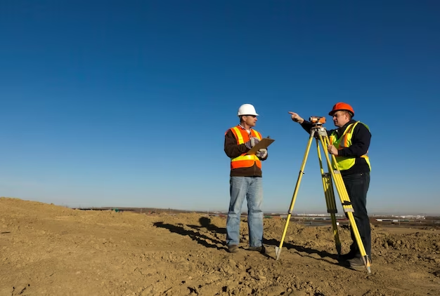
Surveying is indispensable in engineering, providing essential support in a wide range of projects, including the construction of bridges, roads, and skyscrapers. The key roles played by surveyors in engineering projects are as follows:
- Providing Accurate Measurements: Surveyors offer precise measurements of terrain, existing structures, and environmental conditions. These measurements are crucial for engineers to design safe and sustainable constructions. Accurate data ensures that engineering projects are executed with precision, reducing the risk of errors and costly rework.
- Guiding Construction: Surveyors ensure that buildings and infrastructure are constructed in the right location. Through site surveys, they help determine the optimal placement of structures, considering factors such as elevation, terrain, and accessibility. This guidance is vital in ensuring that projects adhere to design specifications and local regulations.
3. Environmental Management
Surveying plays a vital role in environmental management, contributing to various aspects of conservation and risk assessment. Its significance in this context is exemplified through the following applications:
- Mapping Flood Risks: Accurate topographical surveys aid in mapping flood-prone areas. This information is essential for developing effective flood mitigation strategies, such as levees, floodwalls, and drainage systems. By identifying flood risks, surveyors help protect communities and minimize the damage caused by flooding events.
- Wildlife Conservation: Surveying supports wildlife conservation efforts by providing data on habitat boundaries, population density, and migration patterns. This information assists conservationists in creating effective conservation areas and implementing measures to protect endangered species. Survey data also informs land-use planning to balance human development with environmental preservation.
4. Archaeology
In archaeology, surveying is a fundamental tool that aids in the discovery, documentation, and preservation of historical sites. Here are the key aspects where surveying is essential:
Site Discovery and Mapping
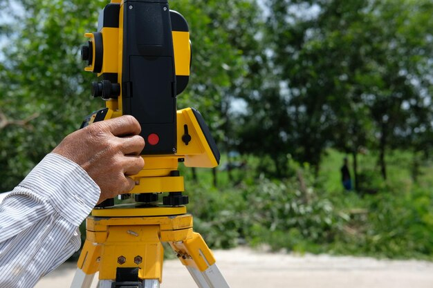
Surveying techniques are instrumental in identifying and mapping archaeological sites. This involves the use of instruments like Total Stations and GPS (Global Positioning System) to accurately record the coordinates of archaeological features, artifacts, and structures. The benefits include:
- Location Precision: Surveying provides precise geographic coordinates, enabling archaeologists to pinpoint the exact locations of historical sites. This is crucial for record-keeping and future research.
- Site Documentation: Survey data helps create detailed site maps, which are essential for documenting the layout, size, and spatial relationships of archaeological features. These maps serve as valuable references for archaeological analysis and interpretation.
- Comparative Studies: Survey data facilitates comparative studies by allowing archaeologists to compare different sites and their spatial arrangements, leading to a deeper understanding of historical contexts.
Preservation
Accurate mapping and surveying are vital for the preservation of archaeological sites. Preservation efforts benefit from surveying in the following ways:
- Site Monitoring: Regular surveys enable archaeologists to monitor the condition of sites over time. Changes in site structures or erosion can be detected early, allowing for timely preservation measures.
- Conservation Planning: Survey data assists in planning conservation and restoration projects. It helps experts determine the extent of damage, prioritize areas for preservation, and develop strategies for site protection.
- Heritage Management: Surveying contributes to the management of cultural heritage sites. It aids in creating comprehensive inventories of historical sites and facilitates heritage site management and protection at regional and national levels.
5. Agriculture

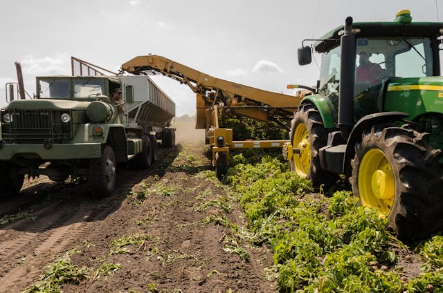
Surveying plays a crucial role in modern agriculture, supporting land management and efficient resource allocation. Here’s how surveying contributes to the agricultural sector:
Land Management
Surveying techniques are essential for efficient land use and management in agriculture. This includes:
- Parcel Identification: Surveying helps delineate property boundaries and accurately identify land parcels. This is crucial for landowners, farmers, and government authorities to establish land ownership and usage rights.
- Topographic Mapping: Topographic surveys provide detailed information about the terrain, including elevation, slopes, and drainage patterns. Farmers use this data to plan crop planting, irrigation, and drainage systems.
- Soil Analysis: Surveying assists in soil sampling and analysis. Soil surveys help farmers understand the composition and fertility of their land, enabling them to make informed decisions about crop selection and fertilization.
Irrigation Planning
Effective irrigation is essential for agricultural productivity. Surveying contributes to irrigation planning in the following ways:
- Terrain Assessment: Survey data helps identify suitable areas for irrigation and assess the feasibility of irrigation projects based on the land’s topography and water source availability.
- Canal Design: Surveyors play a critical role in designing irrigation canals and channels. They ensure proper alignment, gradient, and water distribution efficiency.
- Water Management: Real-time monitoring through surveying tools helps in optimizing water usage and reducing wastage in irrigation systems, promoting sustainable farming practices.
6. Mining
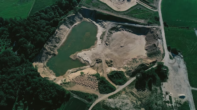
The mining industry heavily relies on surveying for resource estimation, mine planning, and safety measures. Here are the key aspects where surveying is vital:
Resource Estimation
Surveying is crucial for estimating the volume, quality, and value of mineral deposits. This involves:
- Exploration Surveys: Surveyors use various techniques, including geodetic surveys and geophysical surveys, to identify and assess potential mining sites. They collect data on ore bodies, rock quality, and mineral composition.
- Stockpile Measurement: Ongoing surveying is used to measure and manage stockpiles of extracted minerals. Accurate measurements are essential for inventory management and valuation.
- Reserve Calculation: Survey data forms the basis for calculating mineral reserves, which are critical for mining companies’ financial planning and reporting.
Mine Planning and Safety
Surveying plays a vital role in mine design, safety, and operational efficiency:
- Shaft and Tunnel Design: Surveyors create precise plans for mine shafts, tunnels, and access routes, ensuring safe and efficient excavation.
- Geotechnical Monitoring: Continuous surveying is essential to monitor ground stability, detect potential hazards like subsidence, and implement safety measures accordingly.
- Equipment Guidance: Survey data is used for equipment guidance, ensuring accurate drilling, blasting, and ore extraction. This minimizes waste and improves operational efficiency.
7. Transportation

Transportation is a pivotal aspect of modern society, and surveying plays a crucial role in its effective functioning. Here are two key areas where surveying is vital:
- Route Planning: Efficient transportation routes are essential for minimizing travel time and resources. Surveying helps in the design and planning of these routes by providing accurate data on the terrain, obstacles, and other relevant factors. This information enables engineers and planners to create transportation networks that are both cost-effective and environmentally friendly.
- Infrastructure Maintenance: Maintaining existing transportation systems is equally important as planning new ones. Surveying aids in the regular assessment of the condition of roads, bridges, railways, and other infrastructure components. By detecting signs of wear and tear, damage, or structural issues, surveyors help ensure the safety and functionality of transportation networks.
8. Geographic Information Systems (GIS)
Geographic Information Systems (GIS) rely heavily on accurate spatial data, making surveying an indispensable component of GIS development. Surveying contributes significantly in the following ways:
- Data Collection: Surveyors gather precise geographic data, such as coordinates, elevation, and land features, which forms the foundation of GIS databases. This data is essential for creating maps, conducting spatial analysis, and making informed decisions in numerous sectors, including environmental management, urban planning, and agriculture.
- Mapping Applications: GIS applications are diverse and span multiple industries, including agriculture, forestry, and urban planning. Surveying data serves as the backbone for these mapping applications, enabling users to visualize and analyze spatial information effectively. From tracking disease outbreaks to monitoring land use changes, GIS mapping plays a pivotal role in decision-making processes.
9. Disaster Management
Surveying plays a critical role in disaster management, where timely and accurate information can save lives and minimize damage. Here’s how surveying is crucial in this context:
- Hazard Mapping: Surveyors help identify areas prone to natural disasters such as earthquakes, floods, and wildfires. By collecting data on topography, soil composition, and historical disaster patterns, hazard maps can be created. These maps inform authorities, communities, and emergency responders about high-risk areas, enabling better preparedness and risk mitigation strategies.
- Recovery Planning: After a disaster strikes, surveyors are instrumental in assessing the damage and determining the extent of the disaster’s impact. This information is essential for planning and executing recovery efforts. Surveying helps prioritize areas for reconstruction, assess infrastructure damage, and allocate resources efficiently for a rapid and effective recovery.
10. Urban and Regional Planning
In the realm of urban and regional planning, surveying is an indispensable tool for informed decision-making and sustainable development:
- Land Use Planning: Surveyors provide valuable data on land parcels, property boundaries, and land characteristics. This information aids urban planners in zoning, determining suitable land use, and optimizing the allocation of resources. It ensures that cities and regions are developed in a way that promotes efficient land utilization and minimizes conflicts over land rights.
- Infrastructure Development: Effective infrastructure planning is essential for the growth and development of urban and regional areas. Surveying helps identify suitable locations for roads, utilities, and public facilities. By collecting data on terrain, soil, and existing infrastructure, surveyors contribute to the efficient design and implementation of essential infrastructure projects.
Conclusion
The importance of surveying extends across various sectors, playing a crucial role in shaping our world. From establishing property boundaries to aiding in disaster management, the 10 importance of surveying is evident in every aspect of our lives. This field, rich in history and relevance, continues to be fundamental in understanding and planning our world, one measurement at a time.
FAQ
Q: Why is surveying important in real estate?
A: Surveying is crucial in real estate as it helps in establishing accurate property boundaries, which is essential for legal transactions, dispute resolution, and effective land use planning.
Q: Can surveying help in environmental conservation?
A: Absolutely! Surveying aids in environmental conservation by mapping critical habitats, assessing environmental impacts, and aiding in the creation of conservation strategies.
Q: How does surveying contribute to urban planning?
A: Surveying contributes to urban planning by providing accurate land measurements, which are essential for designing urban layouts, infrastructure, and public spaces.
Q: Is surveying important in agriculture?
A: Yes, surveying is very important in agriculture. It helps in land management, planning of irrigation systems, and optimizing the use of agricultural lands.
Q: Do engineers need surveying?
A: Engineers rely heavily on surveying for accurate measurements and data, which are critical for the safe and sustainable design and construction of various structures.







+ There are no comments
Add yours