In the realm of land development and construction, a crucial task is undertaking a topographic survey. To obtain comprehensive data about both natural and artificial characteristics pertaining to specific plots of land, this type of survey becomes necessary. But what exactly does such an assessment involve?
In essence, a topographic survey is an in-depth evaluation that documents the shape, heights and attributes of a land surface. It encompasses various landmarks such as trees, edifices, roadsides pathways, sewage systems and electrical posts among other vital components. Such assessments do not merely involve calculating acreage but rather produce accurate representations through maps which facilitate informed judgments by architects/engineers/planners on how to proceed with their tasks effectively
Why Are Topographic Surveys Important?
Exploring the significance of topographic surveys, their pivotal advantages and uses are emphasized as they supply crucial data regarding the natural terrain. Such information is indispensable for development initiatives involving design, planning, regulatory adherence and vulnerability control.
Design and Planning
Design and planning of construction projects rely heavily on topographic surveys as they establish the groundwork for such ventures. These surveys offer intricate insights into the landscape’s current terrain, comprising precise data concerning elevations, contours, rivers’ positioning alongside natural features like hills and trees. This kind of information enables architects, engineers and designers to devise structures that effectively blend with nature’s elements; thus improving their workmanship quality greatly. The following are some ways in which these types of studies assist design professionals during project development:
| Benefit | Description |
| Accurate Base Data | Topographic surveys offer accurate and precise measurements of the terrain, aiding in design accuracy. |
| Slope Analysis | Information on slopes helps determine optimal building locations and assists in erosion control planning. |
| Drainage Planning | Identifying natural drainage patterns is crucial for designing effective stormwater management systems. |
| Landscape Preservation | Topographic surveys help minimize environmental impact by avoiding disturbance to ecologically sensitive areas. |
Environmental Consideration
Understanding the topography is vital for assessing environmental impacts and ensuring sustainable development. Environmental impact assessments (EIAs) often rely on topographic survey data to evaluate how a project may affect the surrounding ecosystem. Here’s how topographic surveys contribute to environmental consideration:
| Benefit | Description |
| Habitat Preservation | Identifying critical habitats and wildlife corridors allows for proper planning to avoid disruption. |
| Erosion and Sedimentation | Topographic surveys assist in erosion control measures, minimizing soil erosion and sedimentation into water bodies. |
| Wetland Identification | Identifying wetlands ensures compliance with wetland protection laws and avoids ecological damage. |
| Watershed Analysis | Understanding topography aids in watershed management and helps prevent water pollution. |
Legal and Regulatory Compliance
Topographic surveys are often required to comply with local zoning laws and regulations. Authorities use the data to ensure that construction projects adhere to safety and environmental standards. Failure to obtain an accurate topographic survey can lead to legal issues and project delays. Key aspects of legal and regulatory compliance include:
| Benefit | Description |
| Zoning Regulations | Local authorities may require topographic surveys to verify that a proposed project complies with zoning regulations. |
| Environmental Regulations | Compliance with environmental laws often depends on accurate topographic data for impact assessments. |
| Land Use Planning | Topographic surveys aid in land use planning and zoning decisions to ensure orderly development. |
| Property Boundary Disputes | Resolving boundary disputes is facilitated by accurate topographic surveys that establish property lines. |
Risk Management
Topographic surveys play a critical role in identifying potential risks associated with a construction or development project. Understanding the lay of the land helps project managers and stakeholders make informed decisions to mitigate risks. Here are some ways in which topographic surveys contribute to risk management:
| Benefit | Description |
| Flood Risk Assessment | Identifying flood zones and floodplain boundaries helps in designing flood-resistant structures. |
| Geological Hazards | Knowledge of unstable ground and geological hazards enables proactive risk mitigation measures. |
| Soil Stability Analysis | Soil data from topographic surveys aids in assessing soil stability and preventing foundation issues. |
| Infrastructure Planning | Understanding the terrain helps in planning infrastructure to withstand natural disasters like landslides. |
How is a Topographic Survey Conducted?

Conducting a topographic survey involves several steps:
Initial Planning
Before embarking on a topographic survey, surveyors must engage in comprehensive planning. This phase lays the groundwork for the entire survey and involves the following key steps:
- Define Survey Objectives: Surveyors need to determine the specific goals of the survey, such as land development, construction, environmental assessment, or mapping. These objectives shape the survey parameters.
- Site Assessment: A thorough site visit is conducted to assess the terrain, identify potential challenges, and plan access routes for survey equipment and personnel.
- Select Survey Equipment: The choice of surveying instruments is crucial and depends on the project’s requirements. Common equipment includes GPS receivers, total stations, laser scanners, and data loggers.
- Establish Control Points: Control points are strategically placed reference points with known coordinates. They provide a stable foundation for accurate measurements throughout the survey area.
Fieldwork
The fieldwork phase involves physically collecting data from the survey area. Surveyors utilize various tools and techniques to obtain accurate measurements and data points:
- GPS (Global Positioning System): GPS receivers are used to determine precise coordinates of specific locations on the land. This technology relies on satellite signals and is particularly useful for large-scale topographic surveys.
- Total Stations: Total stations are optical instruments that measure angles and distances to calculate the coordinates of points. They are highly accurate and suitable for both small and large survey areas.
- Laser Scanners: Laser scanners emit laser beams and measure the time it takes for the beams to return after hitting a surface. This data is used to create detailed 3D representations of objects and terrain.
- Data Collection: Surveyors collect elevation data, contour information, and details about natural features such as rivers, trees, and man-made structures. They systematically measure and record these data points across the entire survey area.
- Terrain Traversing: Surveyors may traverse rugged terrain on foot or with specialized vehicles to access all areas of the site and gather data.
Data Processing
Once the fieldwork is complete, the collected data is processed to create detailed maps or 3D models of the terrain. This step is essential for transforming raw measurements into usable information:
- Data Cleaning: Survey data often contain errors or inconsistencies due to various factors like atmospheric conditions or instrument inaccuracies. Data cleaning involves identifying and correcting these issues.
- Data Integration: Different data sources, such as GPS, total station measurements, and laser scanning data, are integrated into a unified dataset.
- Terrain Modeling: Software tools are used to create a digital terrain model (DTM) or a digital elevation model (DEM) from the collected data. These models represent the land’s surface with contour lines, providing a clear visualization of elevation changes.
- Map Generation: The final step involves generating topographic maps, 3D models, or other visual representations based on the processed data. These outputs serve as valuable resources for project planning, design, and decision-making.
Understanding the Tools of the Trade
Topographic surveying has evolved with technology. Modern tools include:
GPS (Global Positioning System)
GPS, or Global Positioning System, is a foundational tool in modern topographic surveying. It provides highly accurate positioning data by leveraging signals from a network of satellites orbiting the Earth. Below are key aspects of GPS in topographic surveying:
- Accuracy: GPS delivers precise location data with sub-centimeter accuracy, making it an indispensable tool for mapping and topographic surveys.
- Data Collection: GPS receivers collect latitude, longitude, and elevation data, which is essential for creating accurate topographic maps.
- Real-Time Tracking: Many GPS devices allow real-time tracking of surveyors, enhancing safety and ensuring efficient data collection.
Total Stations
Total Stations are versatile instruments that measure both angles and distances, enabling surveyors to generate precise data points for topographic surveys. Here are some important details about Total Stations:
- Angular Measurement: Total Stations use electronic theodolites to measure horizontal and vertical angles with high precision.
- Distance Measurement: Integrated laser rangefinders calculate distances with accuracy, even for long-range measurements.
- Data Integration: Total Stations can be connected to data loggers or computers to record and process data conveniently.
Laser Scanners
Laser Scanners have become essential tools in topographic surveying due to their ability to capture detailed 3D images of structures and terrain. Key features of laser scanners include:
- Rapid Data Collection: Laser scanners can capture thousands of data points per second, allowing for quick and accurate 3D mapping.
- Point Clouds: The collected data is organized into point clouds, which can be processed to create detailed topographic models and visualizations.
- Applications: Laser scanners are used for a wide range of purposes, including building inspections, terrain modeling, and archaeological site documentation.
Drones
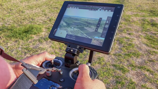
Drones, or Unmanned Aerial Vehicles (UAVs), have revolutionized topographic surveying by providing an aerial perspective, especially for large or inaccessible areas. Here are key points about drones in topographic surveying:
- Aerial Surveys: Drones can capture high-resolution images and videos from above, allowing for efficient mapping of large areas.
- Real-Time Data: Many drones offer real-time data transmission to ground stations, enabling immediate analysis and decision-making.
- Cost-Efficiency: Drones are cost-effective for tasks such as monitoring construction sites, assessing vegetation, and conducting environmental surveys.
Applications of Topographic Surveys
Topographic surveys are used in various fields:
| Field | Purpose |
| Construction | For site planning and design. |
| Environmental Management | To assess the impact on landscapes. |
| Archaeology | For mapping historical sites. |
| Urban Planning | To plan city expansions and infrastructure. |
Conclusion
Topographic surveys are more than just maps; they are comprehensive tools that guide development, planning, and conservation efforts. By understanding the lay of the land, we can build more efficiently, plan more effectively, and protect our environment with greater care.
Remember, the next time you embark on a project that involves land development, a topographic survey is your first step toward success. It’s an investment in accuracy, safety, and sustainability.
FAQ
Q: How long does a topographic survey take?
A: The duration depends on the area’s size and complexity. Small surveys can take a few days, while larger ones might need several weeks.
Q: Are topographic surveys expensive?
A: Costs vary based on the survey’s scope and the terrain’s complexity. However, considering the valuable data they provide, they are often worth the investment.
Q: Do I need a topographic survey for my property?
A: If you’re planning any significant construction or land development, a topographic survey is highly recommended.










+ There are no comments
Add yours